 |
|||||||
| The History of Kennedy
Park Campbells Bay Primary School |
|||||||
|
|||||||
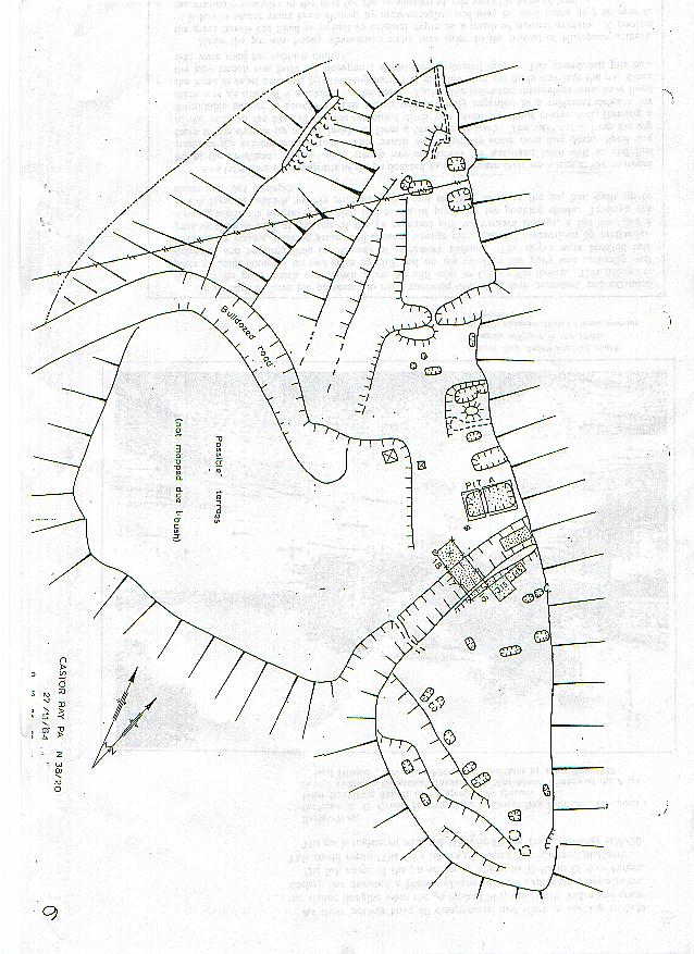
This is a map of Rahopara Pa when the Maori inhabited it showing where the middens (refuse heap), terraces and kumara pits were. The beach is on the right.
Beach Road is on the left and the ocean is on the right. The road is now tar-sealed and most of the park is grass or has been planted with native shrubs. Original source and date of this map is unknown. Back to Our Project
|
|||||||
| Last update: Wednesday, March 27, 2002 at 3:04:09 PM. | |||||||