|
St Peter's College Erinwood Farm |
|
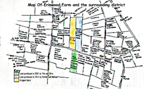
MapHere is a map of Erinwood farm and it's position in the Taikorea District and the other areas of land originally settled by their fellow pioneers.
The key may be a little hard to make out but Yellow refers to the original block settled by the Hehir, Hurley and O'Grady families. Blue corresponds to Amon's farm next door purchased by Patrick for his son Michael in 1912 and Green is the land purchased by Chris and Tim in 2000. |
|